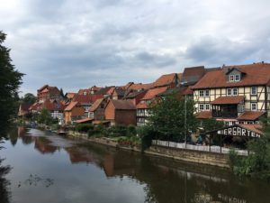
I like traveling along rivers. During the first leg of my expedition farther north, I had spent two days along the river Elbe, some 60 miles of which served as the “inner-German border” during the time of the German division. Now I’ve arrived at the banks of the Werra, a river I had heard about mostly in connection with its dismal water quality and because it is one of the two rivers that combine to form the Weser, my “home” river. The pollution of the Werra (and thus the Weser) stems from the potash mining operations in the federal states of Hesse and Thuringia, which have released waste waters with extremely high concentrations of salt since the middle of the 19th century. On the East German (Thuringian) side of the Werra, the wastewater was allowed to enter the river without any regulations – which is not to say that the wastewater entering the Werra from the Western side was crystal-clear.
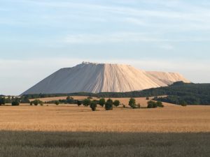
Another manifestation of the potash mining industry is “Monte Kali” (Kali= short for Kalisalz, the German word for potash), a massive mountain of salt tailings that towers more than 800 feet above the surrounding landscape and covers some 240 acres. It was in my view for most the 40 km I rode that day, and the next day, another salt mountain came into view a bit farther south.
While the water quality of the Werra has improved over the last two decades, it is still one of Europe’s most challenged rivers. This and the effects of the salt on the soil and the drinking water will likely keep the neighboring federal states and mining company K+S in problem-solving mode for years to come.
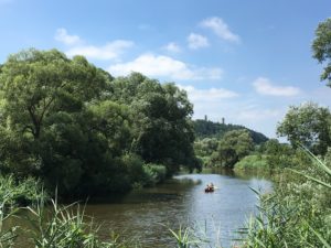
Fortunately, the bike path along the Werra has other views to offer besides the surreal Monte Kali. Along a stretch of the river that used to form the border between East and West Germany, I spot a canoe and wave to its occupants. Needless to say, canoeing was not an option here during the time of the German division. In fact, not far from here the East German border regime had installed a barrier of metal bars across the river where it entered West German territory, to prevent escapes by swimming or diving. Where the border went alongside the river, people from the east (besides border guards) could not even have seen or approached the river.
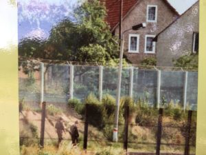
Not much later, as I approach a foot-and-bike bridge across the river, I notice a large board with photos and text. I take a closer look and find, among other things, pictures of the border fence running right in front of the houses in Lauchröden, the village on the eastern side, and of the old bridge that had been destroyed in 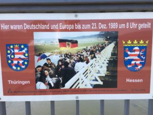 World War II. Another one shows happy people crossing the new bridge. The image is dated December 23, 1989 – only six weeks after the border opened! These people must have been very motivated to reconnect after 4 decades of separation.
I am also impressed that the bridge has remained a pedestrian bridge. Vehicle traffic might have added some convenience, but the peaceful atmosphere of the place would be gone. The distance between the two villages is less than a mile, which can be easily covered on foot or by bike in a few minutes (or by car via a vehicle bridge a few miles down the river).
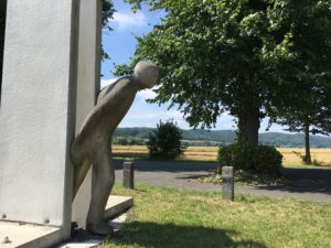
The place invites one to slow down and take in the sweeping landscape, with a view of Brandenburg Castle to one side and wooded hills in the distance all around. And a sculpture near the bridge, of a human figure breaking out from a narrow space between two concrete slabs.
I happen to know that a large part of the surrounding landscape is protected by nature preserves that engaged citizens on both sides of the Werra have fought to establish in and near the former border strip (the Green Belt). And so a careful observer can find storks strutting the fields, spot egg masses of rare species of toads in the old vehicle ditches, and hear the winnowing sounds of the snipe’s courtship display flight, all within sight of the struggling Werra and the potash mountains.
Hi Kerstin,
Nice to rejoin you on your journey after some absence.
Can you explain what purposes potash served in the development of industry in Germany?
Hugs,
Gerard