I had hoped to make it to Point Alpha on the scorching day of the phantom villages, but an unsuccessful shortcut on a hiking trail plus the sweltering heat made that less likely as the day wore on. I had stopped to cross-reference the GPS route with my paper map when three men in athletic biking gear slowed down to ask if they could help. Turns out they could, somewhat: They knew that the small town we were in had no grocery store – I had hoped to replenish my dwindling water supply. They also knew where to connect to the obscure bike path I was looking for, so we rode on together for a few kilometers. It turned out that the three were retired border officers of the Bundesgrenzschutz – the West German border police. I asked them how their jobs had changed after the border became defunct. One of them had been reassigned to Frankfurt Airport, which meant a 2-hour commute to work each way instead of the previous 30 minutes; another was sent to eastern cities like Dresden to respond to far-right wing attacks – needless to say, not a pleasant assignment. Before they pointed me to my route and went on theirs, one of them gave me his extra bottle of apple spritz. This kind gesture probably saved me considerable misery, as it turned out that I had yet another hill to push up to reach Point Alpha.
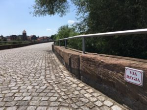
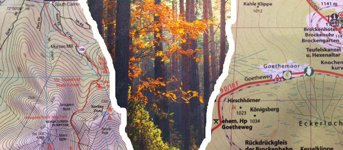
Point Alpha is the name of a former U.S. observation post on the edge of Hesse where it borders Thuringia. During the Cold War, its name served as shorthand for “most likely place for World War III to start”. You see, Point Alpha is located where the territory of former East Germany, and thus the Warsaw Pact, reached the farthest west, and where the lay of the land ‘offered’ itself for warfare. The area is named “Fulda Gap” for the Hessian town of Fulda and two corridors of lowlands that would have offered the most direct route towards Frankfurt and the Rhine Region in a hypothetical Soviet attack. (Incidentally, this topographic feature has been well known and used at least since Roman times. Over many centuries, it was part of a long-distance trade, military, and pilgrimage route known as Via Regia – King’s Way, or King’s Road. During its greatest reach, you could travel on it from Lissabon to Novgorod.)
Today, Point Alpha is a memorial site with an exhibition about the German division and the Cold War, and an academy centered on democracy and international crisis prevention.
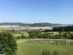
I reached the entrance to Point Alpha with an hour left before closing, and it took me all of five minutes to realize that I would need considerably more than that to give the site proper attention. With a couple of phone calls, I found a reasonably-priced room for the next two nights in the nearby town of Geisa. Before taking off on the much-deserved 3-km downhill ride, I climbed up the observation tower to stand where U.S. Constabulary units once stood within eye contact distance from Warsaw Pact soldiers on the East German watchtower some 600 feet away.
The delightful, minutes-long downhill sail to Geisa convinced me to lock the bike to a fence post half-way up the hill the next morning and hike the remaining mile or so through a meadow.
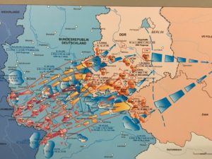
Up at the exhibit center (located right in the former border strip) I immersed myself in maps, video installations, and commentaries by military experts. Here I could follow up close the efforts on both sides to determine, or guess, what weapons the other side had, and to devise responses and deterrents to possible attacks. It was eery to see the illustrations of NATO strategies like “forward strategy,” “massive retaliation,” and “flexible response,” all of which had formed the backdrop to my childhood. No matter where exactly the line of defense was set in a given strategy (in one of them it went right along the Weser, the river on which my home town is located), and no matter whether the hypothetical conflict involved nuclear weapons or not – it was clear from the visual aides that not much would be left of my home country as I knew it. I learned that one of the NATO exercises, dubbed “Operation Carte Blanche” (1955), had assumed the use of some 270 nuclear bombs over West Germany, with an estimated 1.5 million fatalities and 3.5 million injured.
Even though I did not know any of these details at the time, I remember the possibility of nuclear disaster as a backdrop to the feeling of life during my teenage years. As I hiked back down to Geisa, two thoughts went around my mind. As I had just learned at Point Alpha, despite all the precautions to prevent a nuclear war, the world had apparently come incredibly close to such a war in September of 1983, when an underground Soviet monitoring complex in Moscow had detected the launch of four Minuteman rockets from Malmstrom Air Force Base in Montana, each with over 40 times the destructive power of the bomb dropped on Hiroshima and requiring 20 minutes to reach Soviet territory. Amazingly, the commanding lieutenant in Moscow had the mental wherewithal to not react as protocol required for such an eventuality, but to report a false alarm, which was eventually verified.
My other thought was about the situation today. While the threat of nuclear weapons never entirely disappeared after the Cold War, the thought that the leaders of two nuclear powers today are issuing open threats without any hint of diplomacy brings back the old nightmares.
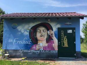
I could use some human contact, I thought. And apparently the universe was listening – by the end of the day, I had made the acquaintance of two delightful Geisa residents. Stay tuned!
And today, as I write this, this bit of good news: The Nobel Peace Prize was just awarded to the International Campaign to Abolish Nuclear Weapons, ICAN. A timely choice.
Thank you for this post. Another presentation of the past, present, political and personal in fluid, clear prose. You are accumulating wonderful material for whatever this project becomes.
[…] down the hill again after my immersion in Cold War strategies, I remembered the sign and decided that this would be the perfect time to find Abel’s bike […]